
Town of Catharine topographic map
Interactive map
Click on the map to display elevation.
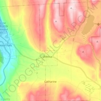
Town of Catharine topographic map, elevation, terrain
About this map
Name: Town of Catharine topographic map, elevation, terrain.
Location: Town of Catharine, Schuyler County, New York, United States (42.29431 -76.79942 42.39032 -76.68805)
Average elevation: 370 m
Minimum elevation: 134 m
Maximum elevation: 588 m
Other topographic maps
Click on a map to view its topography, its elevation and its terrain.