
Thank you for supporting this site ❤️
Make a donation
Make a donation
Kandrian topographic map
Click on the map to display elevation.
Thank you for supporting this site ❤️
Make a donation
Make a donation
About this map
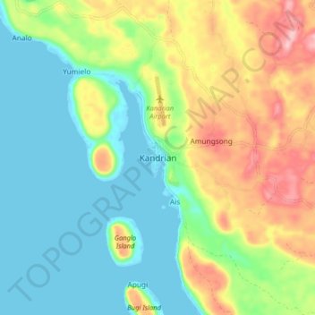
Name: Kandrian topographic map, elevation, terrain.
Location: Kandrian, West New Britain, Islands Region, Papua New Guinea (-6.24742 149.50764 -6.16742 149.58764)
Average elevation: 61 m
Minimum elevation: -1 m
Maximum elevation: 175 m
Thank you for supporting this site ❤️
Make a donation
Make a donation