
Thank you for supporting this site ❤️
Make a donation
Make a donation
Fallston topographic map
Click on the map to display elevation.
Thank you for supporting this site ❤️
Make a donation
Make a donation
About this map
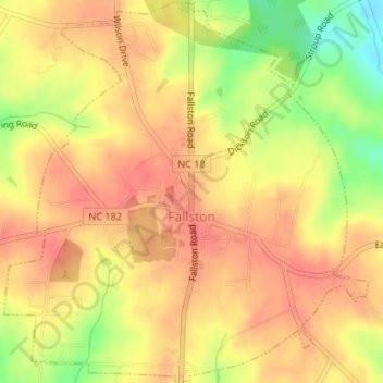
Name: Fallston topographic map, elevation, terrain.
Average elevation: 299 m
Minimum elevation: 260 m
Maximum elevation: 316 m
Thank you for supporting this site ❤️
Make a donation
Make a donation
Other topographic maps
Click on a map to view its topography, its elevation and its terrain.
Thank you for supporting this site ❤️
Make a donation
Make a donation
Osborne Apartments
United States > North Carolina > Cleveland County > Shelby
Average elevation: 256 m