
Thank you for supporting this site ❤️
Make a donation
Make a donation
Sungai Merbok topographic map
Click on the map to display elevation.
Thank you for supporting this site ❤️
Make a donation
Make a donation
About this map
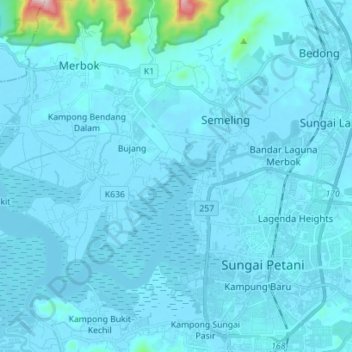
Name: Sungai Merbok topographic map, elevation, terrain.
Location: Sungai Merbok, Bedong, Kuala Muda, Kedah, Malaysia (5.63328 100.37246 5.72368 100.51280)
Average elevation: 29 m
Minimum elevation: -1 m
Maximum elevation: 703 m
Thank you for supporting this site ❤️
Make a donation
Make a donation
Other topographic maps
Click on a map to view its topography, its elevation and its terrain.