
Thank you for supporting this site ❤️
Make a donation
Make a donation
Barxa topographic map
Click on the map to display elevation.
Thank you for supporting this site ❤️
Make a donation
Make a donation
About this map
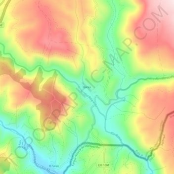
Name: Barxa topographic map, elevation, terrain.
Location: Barxa, A Gudiña, Viana, Ourense, Galicia, 32545, España (41.97305 -7.19693 42.01305 -7.15693)
Average elevation: 789 m
Minimum elevation: 587 m
Maximum elevation: 1,006 m
Thank you for supporting this site ❤️
Make a donation
Make a donation
Other topographic maps
Click on a map to view its topography, its elevation and its terrain.