
Thank you for supporting this site ❤️
Make a donation
Make a donation
Soberton topographic map
Click on the map to display elevation.
Thank you for supporting this site ❤️
Make a donation
Make a donation
About this map
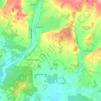
Name: Soberton topographic map, elevation, terrain.
Location: Soberton, Winchester, Hampshire, England, United Kingdom (50.89755 -1.17759 50.96521 -1.09400)
Average elevation: 72 m
Minimum elevation: 24 m
Maximum elevation: 156 m
Thank you for supporting this site ❤️
Make a donation
Make a donation
Other topographic maps
Click on a map to view its topography, its elevation and its terrain.