
Noumea topographic map
Interactive map
Click on the map to display elevation.
About this map
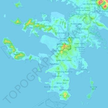
Name: Noumea topographic map, elevation, terrain.
Location: Noumea, South Province, New Caledonia, 98800, France (-22.31253 166.38579 -22.21672 166.50404)
Average elevation: 8 m
Minimum elevation: -4 m
Maximum elevation: 206 m
Other topographic maps
Click on a map to view its topography, its elevation and its terrain.