
Thank you for supporting this site ❤️
Make a donation
Make a donation
Tupi topographic map
Click on the map to display elevation.
Thank you for supporting this site ❤️
Make a donation
Make a donation
About this map
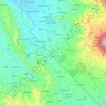
Name: Tupi topographic map, elevation, terrain.
Location: Tupi, South Cotabato, Soccsksargen, 9505, Philippines (6.25102 124.86801 6.42636 125.10528)
Average elevation: 457 m
Minimum elevation: 77 m
Maximum elevation: 1,832 m
Thank you for supporting this site ❤️
Make a donation
Make a donation
Other topographic maps
Click on a map to view its topography, its elevation and its terrain.