
Lower Makefield Township topographic map
Interactive map
Click on the map to display elevation.
About this map
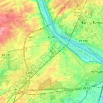
Name: Lower Makefield Township topographic map, elevation, terrain.
Average elevation: 45 m
Minimum elevation: 4 m
Maximum elevation: 106 m
Other topographic maps
Click on a map to view its topography, its elevation and its terrain.
Feasterville
United States > Pennsylvania > Bucks County > Lower Southampton Township
Average elevation: 66 m