
Thank you for supporting this site ❤️
Make a donation
Make a donation
City Heights topographic map
Click on the map to display elevation.
Thank you for supporting this site ❤️
Make a donation
Make a donation
About this map
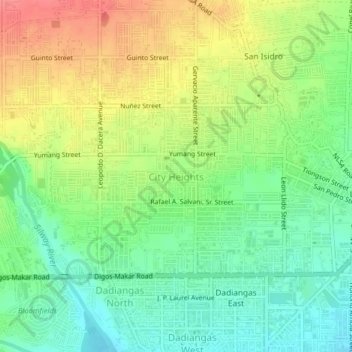
Name: City Heights topographic map, elevation, terrain.
Location: City Heights, General Santos, Soccsksargen, 9500, Philippines (6.11003 125.14919 6.15003 125.18919)
Average elevation: 37 m
Minimum elevation: 6 m
Maximum elevation: 78 m
Thank you for supporting this site ❤️
Make a donation
Make a donation