
Make a donation
Oviedo topographic map
Click on the map to display elevation.
Make a donation
Oviedo
Oviedo is located in the centre of Asturias between the Nalón River and Nora River. To the north lie Las Regueras and Llanera, to the south Mieres and Ribera de Arriba, to the east Siero and Langreo, and to the west Grado and Santo Adriano. The altitude of Oviedo is between 80 and 709 metres above sea level. The city is protected against strong winds by Monte Naranco in the north and the Sierra del Aramo in the south. The city centre is rather hilly.
Make a donation
About this map
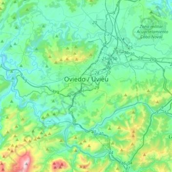
Name: Oviedo topographic map, elevation, terrain.
Location: Oviedo, Asturias, Spain (43.27914 -6.01694 43.42732 -5.74239)
Average elevation: 284 m
Minimum elevation: 59 m
Maximum elevation: 1,282 m
Make a donation
Other topographic maps
Click on a map to view its topography, its elevation and its terrain.