
Thank you for supporting this site ❤️
Make a donation
Make a donation
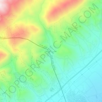
Temnin el-Foka topographic map
Click on the map to display elevation.
Thank you for supporting this site ❤️
Make a donation
Make a donation
Temnin el-Foka
Temnin el-Foka (Arabic: تمنين الفوقا) is a village located approximately 28 kilometers southwest of Baalbek in the Baalbek District, in the Beqaa valley of Lebanon, at an altitude of 1100 meters above sea level. The village is famous for its Roman nymphaeum which is close to the spring of Ain el-Jobb.
Thank you for supporting this site ❤️
Make a donation
Make a donation
About this map
Name: Temnin el-Foka topographic map, elevation, terrain.
Average elevation: 1,155 m
Minimum elevation: 932 m
Maximum elevation: 1,601 m
Thank you for supporting this site ❤️
Make a donation
Make a donation