
Thank you for supporting this site ❤️
Make a donation
Make a donation
Bulad topographic map
Click on the map to display elevation.
Thank you for supporting this site ❤️
Make a donation
Make a donation
About this map
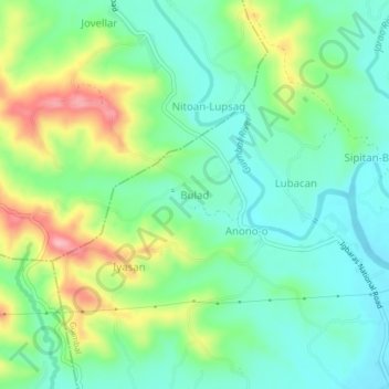
Name: Bulad topographic map, elevation, terrain.
Location: Bulad, Guimbal, Iloilo, Western Visayas, 5029, Philippines (10.66332 122.27086 10.70332 122.31086)
Average elevation: 58 m
Minimum elevation: 5 m
Maximum elevation: 168 m
Thank you for supporting this site ❤️
Make a donation
Make a donation
Other topographic maps
Click on a map to view its topography, its elevation and its terrain.