
Charallave topographic map
Interactive map
Click on the map to display elevation.
About this map
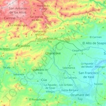
Name: Charallave topographic map, elevation, terrain.
Location: Charallave, Municipio Cristóbal Rojas, Miranda, Venezuela (10.08566 -67.01866 10.40566 -66.69866)
Average elevation: 568 m
Minimum elevation: 126 m
Maximum elevation: 1,726 m