

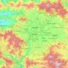
Kathmandu Valley topographic map
Click on the map to display elevation.
Kathmandu Valley
Kathmandu valley is bowl-shaped. Its central lower part stands at 1,425 metres (4,675 ft) above sea level. Kathmandu valley is surrounded by four mountain ranges: Shivapuri hills (at an elevation of 2,732 metres or 8,963 feet), Phulchowki (2,695 metres or 8,842 feet), Nagarjun (2,095 metres or 6,873 feet) and Chandragiri (2,551 metres or 8,369 feet). The major river flowing through the Kathmandu Valley is the Bagmati River. The valley is made up of the Kathmandu District, Lalitpur District and Bhaktapur District covering an area of 220 square miles (570 km2). The valley consists of the municipal areas of Kathmandu, Patan, Bhaktapur, Kirtipur and Madhyapur Thimi; the remaining area is made up of a number of municipalities and rural municipalities (in Lalitpur district). The valley is a cultural and political hub of Nepal. The Kathmandu valley was accorded the status of a World Heritage Site by UNESCO in the year 1979.
About this map

Name: Kathmandu Valley topographic map, elevation, terrain.
Location: Kathmandu Valley, Lalitpur, Bagamati Province, Nepal (27.52802 85.23380 27.75476 85.53132)
Average elevation: 1,595 m
Minimum elevation: 860 m
Maximum elevation: 2,809 m
Other topographic maps
Click on a map to view its topography, its elevation and its terrain.

Lalitpur
Nepal > Bagamati Province > Lalitpur
Lalitpur (Nepali: ललितपुर [ləˈlɪt̪pʊɾ]), locally known as Yala (Nepal Bhasa: 𑐫𑐮 [jəˈlʌ]) is a metropolitan city and fourth most populous city of Nepal with 299,843 inhabitants living in 77,159 households per the 2021 census. It is located in the south-central part of…
Average elevation: 1,608 m
Lalitpur
Nepal > Bagamati Province > Lalitpur
Lalitpur Metropolitan City (Sanskrit: पाटन Pāṭana, Nepal bhasa : 𑐫𑐮 Yala) is a metropolitan city and fourth most populous city of Nepal with 299,843 inhabitants living in 49,044 households per the 2021 census. It is located in the south-central part of Kathmandu Valley, a large valley in…
Average elevation: 1,608 m

Lalitpur
Nepal > Bagamati Province > Lalitpur
Lalitpur (Nepali: ललितपुर) is a metropolitan city and fourth most populous city of Nepal with 299,843 inhabitants living in 77,159 households per the 2021 census. It is located in the south-central part of Kathmandu Valley, a large valley in the high plateaus in central Nepal, at an altitude of…
Average elevation: 1,608 m
Lalitpur
Nepal > Bagamati Province > Lalitpur
Lalitpur Metropolitan City (Sanskrit: पाटन Pāṭana, Nepal bhasa : 𑐫𑐮 Yela, ) is a Metropolitan city and fourth most populous city of Nepal with 299,843 inhabitants living in 49,044 households per 2021 census. It is located in the south-central part of Kathmandu Valley, a large valley in the…
Average elevation: 1,608 m

Lalitpur
Nepal > Bagamati Province > Lalitpur
Lalitpur Metropolitan City (Sanskrit: पाटन Pāṭana, Nepal bhasa : 𑐫𑐮 Yela, ) is a Metropolitan city and fourth most populous city of Nepal with 299,843 inhabitants living in 49,044 households per 2021 census. It is located in the south-central part of Kathmandu Valley, a large valley in the…
Average elevation: 1,608 m

Lalitpur
Nepal > Bagamati Province > Lalitpur
Lalitpur (Nepali: ललितपुर) is a metropolitan city and fourth most populous city of Nepal with 299,843 inhabitants living in 77,159 households per the 2021 census. It is located in the south-central part of Kathmandu Valley, a large valley in the high plateaus in central Nepal, at an altitude of…
Average elevation: 1,608 m

Lalitpur
Nepal > Bagamati Province > Lalitpur
Lalitpur Metropolitan City (Nepali: ललितपुर महानगरपालिका, Lālitapura Mahānagarapālikā), also known as Patan (Sanskrit: पाटन, Pāṭana), Yala (Newar: 𑐫𑐮), and Manigal, is a metropolitan city and fourth most populous city of Nepal with 299,843 inhabitants…
Average elevation: 1,608 m

Lalitpur
Nepal > Bagamati Province > Lalitpur
Lalitpur Metropolitan City (Nepali: ललितपुर महानगरपालिका, Lālitapura Mahānagarapālikā), also known as Patan (Sanskrit: पाटन, Pāṭana), Yala (Newar: 𑐫𑐮), and Manigal, is a metropolitan city and fourth most populous city of Nepal with 299,843 inhabitants…
Average elevation: 1,608 m

