
Yangshuo County topographic map
Interactive map
Click on the map to display elevation.
About this map
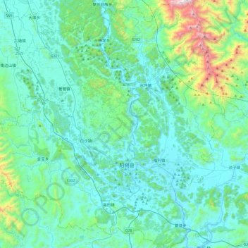
Name: Yangshuo County topographic map, elevation, terrain.
Location: Yangshuo County, Guilin, Guangxi, China (24.63691 110.22279 25.06661 110.67843)
Average elevation: 319 m
Minimum elevation: 93 m
Maximum elevation: 1,659 m
Other topographic maps
Click on a map to view its topography, its elevation and its terrain.
Xing'an County
Xing'an County, Guilin, Guangxi, China
Average elevation: 547 m