
Tequesquitengo topographic map
Interactive map
Click on the map to display elevation.
About this map
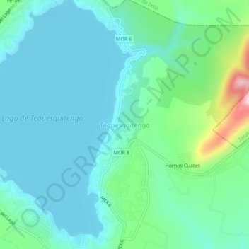
Name: Tequesquitengo topographic map, elevation, terrain.
Location: Tequesquitengo, Jojutla, Morelos, 62909, México (18.59911 -99.27621 18.63911 -99.23621)
Average elevation: 942 m
Minimum elevation: 892 m
Maximum elevation: 1,149 m
Other topographic maps
Click on a map to view its topography, its elevation and its terrain.
Lago de Tequesquitengo
México > Morelos > Jojutla > Tequesquitengo
Lago de Tequesquitengo, Tequesquitengo, Jojutla, Morelos, México
Average elevation: 929 m