
Gravetsch topographic map
Interactive map
Click on the map to display elevation.
About this map
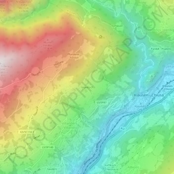
Name: Gravetsch topographic map, elevation, terrain.
Average elevation: 977 m
Minimum elevation: 496 m
Maximum elevation: 1,735 m
Other topographic maps
Click on a map to view its topography, its elevation and its terrain.
Sauders
Italien > Trentino-Südtirol > Bozen > Villanders > Sauders
Sauders, Villanders, Eisacktal, Bozen, Trentino-Südtirol, 39043, Italien
Average elevation: 933 m