
Schling topographic map
Interactive map
Click on the map to display elevation.
About this map
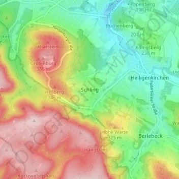
Name: Schling topographic map, elevation, terrain.
Average elevation: 255 m
Minimum elevation: 143 m
Maximum elevation: 401 m
Other topographic maps
Click on a map to view its topography, its elevation and its terrain.
Klüt
Deutschland > Nordrhein-Westfalen > Kreis Lippe > Detmold
Klüt, Detmold, Kreis Lippe, Nordrhein-Westfalen, Deutschland
Average elevation: 187 m
Berlebeck
Deutschland > Nordrhein-Westfalen > Kreis Lippe > Detmold
Berlebeck, Detmold, Kreis Lippe, Nordrhein-Westfalen, Deutschland
Average elevation: 296 m