
Thank you for supporting this site ❤️
Make a donation
Make a donation
Stokes Point topographic map
Click on the map to display elevation.
Thank you for supporting this site ❤️
Make a donation
Make a donation
About this map
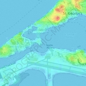
Name: Stokes Point topographic map, elevation, terrain.
Location: Stokes Point, GE 02, Bermuda (32.37270 -64.68831 32.37280 -64.68821)
Average elevation: 5 m
Minimum elevation: -3 m
Maximum elevation: 46 m
Thank you for supporting this site ❤️
Make a donation
Make a donation