
Thank you for supporting this site ❤️
Make a donation
Make a donation
Foia topographic map
Click on the map to display elevation.
Thank you for supporting this site ❤️
Make a donation
Make a donation
About this map
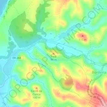
Name: Foia topographic map, elevation, terrain.
Location: Foia, Aljezur, Faro, 8670-230, Portugal (37.20103 -8.87589 37.20113 -8.87579)
Average elevation: 48 m
Minimum elevation: 0 m
Maximum elevation: 128 m
Thank you for supporting this site ❤️
Make a donation
Make a donation
Other topographic maps
Click on a map to view its topography, its elevation and its terrain.