
Kaliganj topographic map
Interactive map
Click on the map to display elevation.
About this map
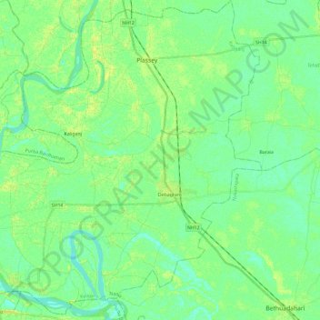
Name: Kaliganj topographic map, elevation, terrain.
Location: Kaliganj, Nadia, Bengala Occidentale, India (23.60271 88.13411 23.81588 88.36750)
Average elevation: 15 m
Minimum elevation: 8 m
Maximum elevation: 24 m
Other topographic maps
Click on a map to view its topography, its elevation and its terrain.
বাগডোগরা
India > Bengala Occidentale > বাগডোগরা
বাগডোগরা, Darjiling, Darjeeling, Bengala Occidentale, India
Average elevation: 136 m