
Don topographic map
Interactive map
Click on the map to display elevation.
About this map
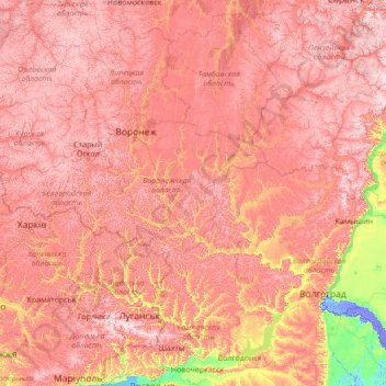
Name: Don topographic map, elevation, terrain.
Average elevation: 149 m
Minimum elevation: -20 m
Maximum elevation: 353 m
Other topographic maps
Click on a map to view its topography, its elevation and its terrain.
Сазан
Russie > Oblast de Voronej > Дьяченковское сельское поселение
Сазан, Дьяченковское сельское поселение, Богучарский район, Oblast de Voronej, District fédéral central, Russie
Average elevation: 97 m