
Thank you for supporting this site ❤️
Make a donation
Make a donation
Moody topographic map
Click on the map to display elevation.
Thank you for supporting this site ❤️
Make a donation
Make a donation
About this map
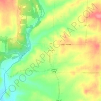
Name: Moody topographic map, elevation, terrain.
Location: Moody, Howell County, Missouri, 65777, United States (36.50951 -92.00932 36.54951 -91.96932)
Average elevation: 293 m
Minimum elevation: 250 m
Maximum elevation: 335 m
Thank you for supporting this site ❤️
Make a donation
Make a donation
Other topographic maps
Click on a map to view its topography, its elevation and its terrain.