
Thank you for supporting this site ❤️
Make a donation
Make a donation
Somers topographic map
Click on the map to display elevation.
Thank you for supporting this site ❤️
Make a donation
Make a donation
About this map
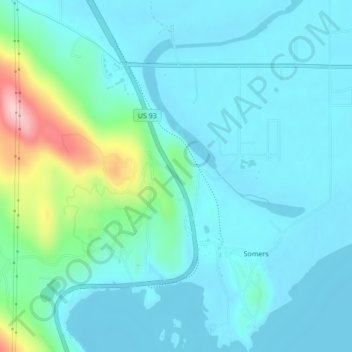
Name: Somers topographic map, elevation, terrain.
Location: Somers, Flathead County, Montana, United States (48.07233 -114.25067 48.10066 -114.21253)
Average elevation: 915 m
Minimum elevation: 879 m
Maximum elevation: 1,091 m
Thank you for supporting this site ❤️
Make a donation
Make a donation