
Cieneguitas topographic map
Interactive map
Click on the map to display elevation.
About this map
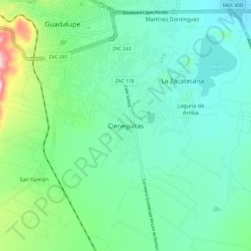
Name: Cieneguitas topographic map, elevation, terrain.
Location: Cieneguitas, Guadalupe, Zacatecas, 98605, México (22.67453 -102.53430 22.75453 -102.45430)
Average elevation: 2,261 m
Minimum elevation: 2,187 m
Maximum elevation: 2,519 m
Other topographic maps
Click on a map to view its topography, its elevation and its terrain.