
Thank you for supporting this site ❤️
Make a donation
Make a donation
Barrier Range topographic map
Click on the map to display elevation.
Thank you for supporting this site ❤️
Make a donation
Make a donation
About this map
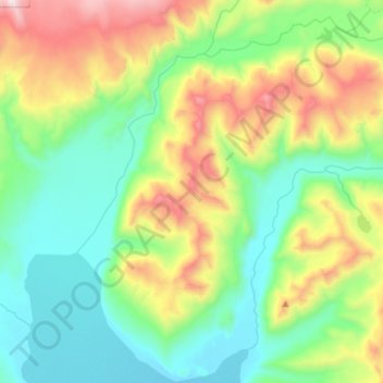
Name: Barrier Range topographic map, elevation, terrain.
Location: Barrier Range, Kodiak Island, Alaska, United States (58.10319 -154.99735 58.22010 -154.70415)
Average elevation: 456 m
Minimum elevation: 11 m
Maximum elevation: 1,544 m
Thank you for supporting this site ❤️
Make a donation
Make a donation
Other topographic maps
Click on a map to view its topography, its elevation and its terrain.