
Thank you for supporting this site ❤️
Make a donation
Make a donation
Akron topographic map
Click on the map to display elevation.
Thank you for supporting this site ❤️
Make a donation
Make a donation
About this map
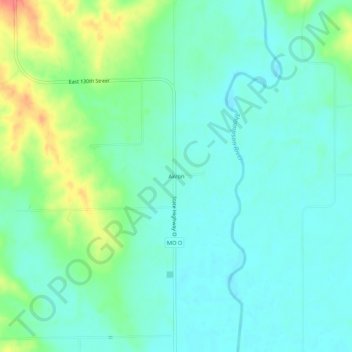
Name: Akron topographic map, elevation, terrain.
Location: Akron, Harrison County, Missouri, United States (40.49945 -93.83745 40.53945 -93.79745)
Average elevation: 272 m
Minimum elevation: 256 m
Maximum elevation: 315 m
Thank you for supporting this site ❤️
Make a donation
Make a donation
Other topographic maps
Click on a map to view its topography, its elevation and its terrain.