
Thank you for supporting this site ❤️
Make a donation
Make a donation
Port Sudan topographic map
Click on the map to display elevation.
Thank you for supporting this site ❤️
Make a donation
Make a donation
About this map
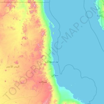
Name: Port Sudan topographic map, elevation, terrain.
Location: Port Sudan, Red Sea State, 79800, Sudan (19.00979 33.25248 21.12145 37.55506)
Average elevation: 292 m
Minimum elevation: -3 m
Maximum elevation: 2,127 m
Thank you for supporting this site ❤️
Make a donation
Make a donation