
Thank you for supporting this site ❤️
Make a donation
Make a donation
Tolaga Bay topographic map
Click on the map to display elevation.
Thank you for supporting this site ❤️
Make a donation
Make a donation
About this map
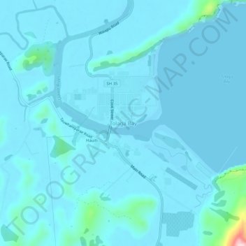
Name: Tolaga Bay topographic map, elevation, terrain.
Location: Tolaga Bay, Gisborne District, Gisborne, 4046, New Zealand (-38.39448 178.27910 -38.35448 178.31910)
Average elevation: 17 m
Minimum elevation: -2 m
Maximum elevation: 273 m
Gisborne District trails, hiking, mountain biking, running and outdoor activities
Thank you for supporting this site ❤️
Make a donation
Make a donation
Other topographic maps
Click on a map to view its topography, its elevation and its terrain.