
Warco topographic map
Interactive map
Click on the map to display elevation.
About this map
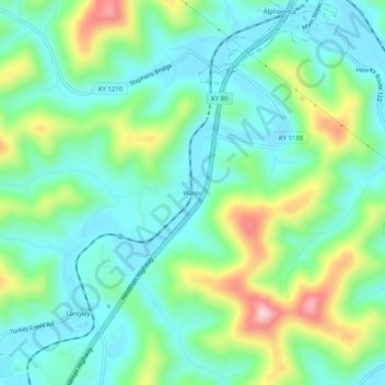
Name: Warco topographic map, elevation, terrain.
Location: Warco, Floyd County, Kentucky, 41645, United States (37.52427 -82.79572 37.56427 -82.75572)
Average elevation: 269 m
Minimum elevation: 190 m
Maximum elevation: 473 m
Other topographic maps
Click on a map to view its topography, its elevation and its terrain.
McDowell
United States > Kentucky > Floyd County
McDowell, Floyd County, Kentucky, 41647, United States
Average elevation: 324 m
Weeksbury
United States > Kentucky > Floyd County
Weeksbury, Floyd County, Kentucky, 41669, United States
Average elevation: 487 m
Harold
United States > Kentucky > Floyd County
Harold, Floyd County, Kentucky, 41635, United States
Average elevation: 268 m
Eastern
United States > Kentucky > Floyd County
Eastern, Floyd County, Kentucky, 41622, United States
Average elevation: 274 m