Bridgewater topographic map
Click on the map to display elevation.
About this map
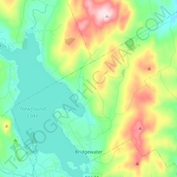
Name: Bridgewater topographic map, elevation, terrain.
Location: Bridgewater, Grafton County, New Hampshire, United States (43.62463 -71.76183 43.71750 -71.64695)
Average elevation: 302 m
Minimum elevation: 148 m
Maximum elevation: 662 m
Other topographic maps
Click on a map to view its topography, its elevation and its terrain.


Streeter Mountain
United States > New Hampshire > Grafton County > Dorchester
Average elevation: 449 m



The Village of Loon Mountain
United States > New Hampshire > Grafton County > Lincoln
Average elevation: 532 m




Ashland
United States > New Hampshire > Grafton County > Ashland
The CDP is in the southwestern part of the town of Ashland, on both sides of the Squam River, which descends 50 feet (15 m) through the center of town. The CDP is bordered to the south by the town of New Hampton and to the west by Interstate 93. The northern border of the CDP runs east and west from the…
Average elevation: 247 m



Stinson Lake
United States > New Hampshire > Grafton County > Rumney > Stinson Lake
Average elevation: 460 m



Mount Kineo, East Peak
United States > New Hampshire > Grafton County > Ellsworth
Average elevation: 710 m