
Thank you for supporting this site ❤️
Make a donation
Make a donation
Rio Piura topographic map
Click on the map to display elevation.
Thank you for supporting this site ❤️
Make a donation
Make a donation
About this map
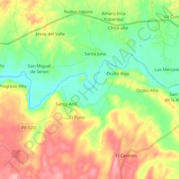
Name: Rio Piura topographic map, elevation, terrain.
Location: Rio Piura, Tambogrande, Tambo Grande, Piura, Perú (-4.96761 -80.45394 -4.91335 -80.31477)
Average elevation: 96 m
Minimum elevation: 45 m
Maximum elevation: 169 m
Thank you for supporting this site ❤️
Make a donation
Make a donation