
Thank you for supporting this site ❤️
Make a donation
Make a donation
Gagalot topographic map
Click on the map to display elevation.
Thank you for supporting this site ❤️
Make a donation
Make a donation
About this map
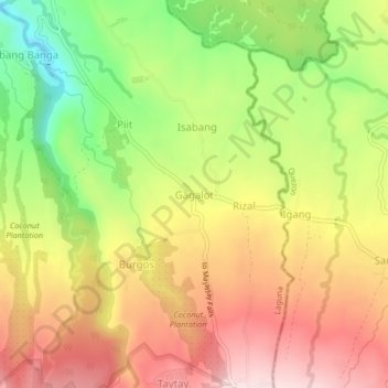
Name: Gagalot topographic map, elevation, terrain.
Location: Gagalot, Majayjay, Laguna, Calabarzon, 4005, Philippines (14.11439 121.48731 14.15439 121.52731)
Average elevation: 412 m
Minimum elevation: 207 m
Maximum elevation: 591 m
Thank you for supporting this site ❤️
Make a donation
Make a donation
Other topographic maps
Click on a map to view its topography, its elevation and its terrain.