
Mohave County topographic map
Interactive map
Click on the map to display elevation.
About this map
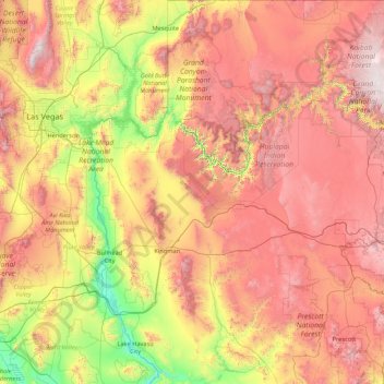
Name: Mohave County topographic map, elevation, terrain.
Location: Mohave County, Arizona, United States of America (34.20977 -114.75562 37.00082 -112.52897)
Average elevation: 1,193 m
Minimum elevation: 114 m
Maximum elevation: 2,877 m
Other topographic maps
Click on a map to view its topography, its elevation and its terrain.
Grand Canyon Village
United States of America > Arizona > Grand Canyon Village
Grand Canyon Village, Coconino County, Arizona, United States of America
Average elevation: 1,764 m
Winslow
United States of America > Arizona > Winslow
Winslow, Navajo County, Arizona, United States of America
Average elevation: 1,495 m
Flagstaff
United States of America > Arizona > Flagstaff
Flagstaff, Coconino County, Arizona, United States of America
Average elevation: 2,176 m