
Thank you for supporting this site ❤️
Make a donation
Make a donation
Dover topographic map
Click on the map to display elevation.
Thank you for supporting this site ❤️
Make a donation
Make a donation
About this map
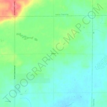
Name: Dover topographic map, elevation, terrain.
Location: Dover, Grant Township, Clare County, Michigan, United States (43.86752 -84.76780 43.90752 -84.72780)
Average elevation: 279 m
Minimum elevation: 257 m
Maximum elevation: 331 m
Thank you for supporting this site ❤️
Make a donation
Make a donation
Other topographic maps
Click on a map to view its topography, its elevation and its terrain.
Thank you for supporting this site ❤️
Make a donation
Make a donation
Thank you for supporting this site ❤️
Make a donation
Make a donation
Thank you for supporting this site ❤️
Make a donation
Make a donation
Thank you for supporting this site ❤️
Make a donation
Make a donation