
Tokanui topographic map
Click on the map to display elevation.
About this map
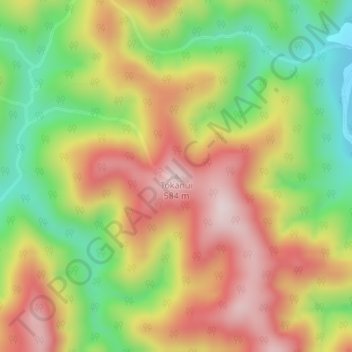
Name: Tokanui topographic map, elevation, terrain.
Location: Tokanui, Whakatāne District, Bay of Plenty, New Zealand (-38.30080 177.09209 -38.30070 177.09219)
Average elevation: 349 m
Minimum elevation: 126 m
Maximum elevation: 565 m
Whakatane District trails, hiking, mountain biking, running and outdoor activities
Other topographic maps
Click on a map to view its topography, its elevation and its terrain.