
Thank you for supporting this site ❤️
Make a donation
Make a donation
Millbrook topographic map
Click on the map to display elevation.
Thank you for supporting this site ❤️
Make a donation
Make a donation
About this map
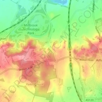
Name: Millbrook topographic map, elevation, terrain.
Location: Millbrook, Central Bedfordshire, England, United Kingdom (52.01574 -0.54831 52.05501 -0.50489)
Average elevation: 83 m
Minimum elevation: 29 m
Maximum elevation: 137 m
Thank you for supporting this site ❤️
Make a donation
Make a donation