
Mount Camiguin topographic map
Click on the map to display elevation.
Mount Camiguin
The well-forested Mount Camiguin or Camiguin de Babuyanes has an elevation of 712 metres (2,336 ft) asl, and a base diameter of 3,200 metres (10,500 ft). It occupies the southwest tip of 22 km (14 mi) long Camiguin Island.
About this map
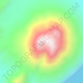
Name: Mount Camiguin topographic map, elevation, terrain.
Average elevation: 288 m
Minimum elevation: 0 m
Maximum elevation: 684 m