
Thank you for supporting this site ❤️
Make a donation
Make a donation
Benhar topographic map
Click on the map to display elevation.
Thank you for supporting this site ❤️
Make a donation
Make a donation
About this map
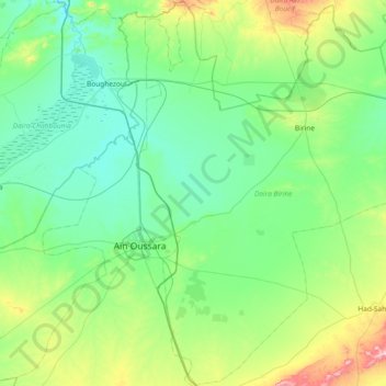
Name: Benhar topographic map, elevation, terrain.
Location: Benhar, Birine District, Djelfa, Algeria (35.22862 2.90333 35.83238 3.22911)
Average elevation: 729 m
Minimum elevation: 615 m
Maximum elevation: 1,222 m
Thank you for supporting this site ❤️
Make a donation
Make a donation