
Make a donation
Thoreau topographic map
Click on the map to display elevation.
Make a donation
Thoreau
Thoreau is located at an altitude of approximately 2,200 meters (7,200 feet) above sea level, and 8 kilometers (5.0 mi) east of the continental divide. Thoreau is located in a broad valley beneath a large escarpment of Entrada sandstone, which marks the southern boundary of the Colorado Plateau to the north. Mount Powell and Castle Rock are landmarks along this escarpment adjacent to Thoreau. The Zuñi Mountains are to the south.
Make a donation
About this map
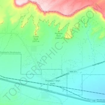
Name: Thoreau topographic map, elevation, terrain.
Location: Thoreau, McKinley County, New Mexico, 87323, United States (35.38735 -108.27384 35.45973 -108.18253)
Average elevation: 2,253 m
Minimum elevation: 2,138 m
Maximum elevation: 2,591 m
Make a donation
Other topographic maps
Click on a map to view its topography, its elevation and its terrain.
Make a donation
Pueblo Pintado
United States > New Mexico > McKinley County > Pueblo Pintado
Average elevation: 1,981 m
Make a donation