
Thank you for supporting this site ❤️
Make a donation
Make a donation
Avery Island topographic map
Click on the map to display elevation.
Thank you for supporting this site ❤️
Make a donation
Make a donation
About this map
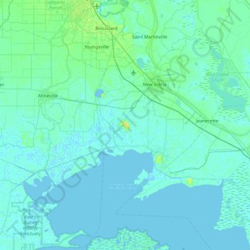
Name: Avery Island topographic map, elevation, terrain.
Location: Avery Island, Iberia Parish, Louisiana, 70513, United States (29.57854 -92.22623 30.21854 -91.58623)
Average elevation: 3 m
Minimum elevation: -5 m
Maximum elevation: 45 m
Thank you for supporting this site ❤️
Make a donation
Make a donation
Other topographic maps
Click on a map to view its topography, its elevation and its terrain.