
Thank you for supporting this site ❤️
Make a donation
Make a donation
Ashford topographic map
Click on the map to display elevation.
Thank you for supporting this site ❤️
Make a donation
Make a donation
About this map
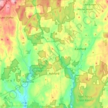
Name: Ashford topographic map, elevation, terrain.
Location: Ashford, Windham County, Connecticut, United States (41.83252 -72.21756 41.95934 -72.10999)
Average elevation: 202 m
Minimum elevation: 100 m
Maximum elevation: 356 m
Thank you for supporting this site ❤️
Make a donation
Make a donation