
Thank you for supporting this site ❤️
Make a donation
Make a donation
Sonora topographic map
Click on the map to display elevation.
Thank you for supporting this site ❤️
Make a donation
Make a donation
Sonora
Sonora is located at 37°59′04″N 120°22′54″W / 37.984361°N 120.381767°W / 37.984361; -120.381767, around the intersection of California State Highways 49 and 108 The altitude is 1,825 feet (556 m). According to the United States Census Bureau, the city has a total area of 3.1 square miles (8.0 km2), 99.55% of it land and 0.45% of it water.
Thank you for supporting this site ❤️
Make a donation
Make a donation
About this map
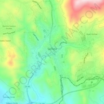
Name: Sonora topographic map, elevation, terrain.
Location: Sonora, Tuolumne County, California, United States (37.96480 -120.39674 38.00329 -120.35892)
Average elevation: 614 m
Minimum elevation: 469 m
Maximum elevation: 866 m
Thank you for supporting this site ❤️
Make a donation
Make a donation