
Lupa topographic map
Click on the map to display elevation.
About this map
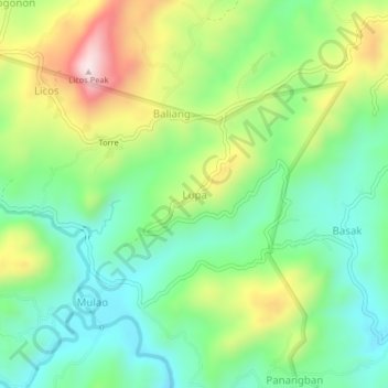
Name: Lupa topographic map, elevation, terrain.
Location: Lupa, Cebu, Central Visayas, 6003, Philippines (10.46987 123.93598 10.50987 123.97598)
Average elevation: 224 m
Minimum elevation: 54 m
Maximum elevation: 534 m
Other topographic maps
Click on a map to view its topography, its elevation and its terrain.