
Thank you for supporting this site ❤️
Make a donation
Make a donation
Benewah topographic map
Click on the map to display elevation.
Thank you for supporting this site ❤️
Make a donation
Make a donation
About this map
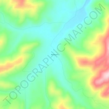
Name: Benewah topographic map, elevation, terrain.
Location: Benewah, Benewah County, Idaho, United States (47.20768 -116.80434 47.24768 -116.76434)
Average elevation: 925 m
Minimum elevation: 821 m
Maximum elevation: 1,133 m
Thank you for supporting this site ❤️
Make a donation
Make a donation
Other topographic maps
Click on a map to view its topography, its elevation and its terrain.
Tensed
United States > Idaho > Benewah County
Tensed is located at 47°9′37″N 116°55′27″W / 47.16028°N 116.92417°W / 47.16028; -116.92417 (47.160284, -116.924304), at an elevation of 2,562 feet (781 m) above sea level.
Average elevation: 785 m