
Ponga topographic map
Click on the map to display elevation.
About this map
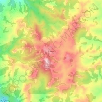
Name: Ponga topographic map, elevation, terrain.
Location: Ponga, Franklin, Auckland, 2577, New Zealand (-37.12913 174.99214 -37.08913 175.03214)
Average elevation: 211 m
Minimum elevation: 65 m
Maximum elevation: 323 m
Auckland trails, hiking, mountain biking, running and outdoor activities