
Thank you for supporting this site ❤️
Make a donation
Make a donation
Herod topographic map
Click on the map to display elevation.
Thank you for supporting this site ❤️
Make a donation
Make a donation
About this map
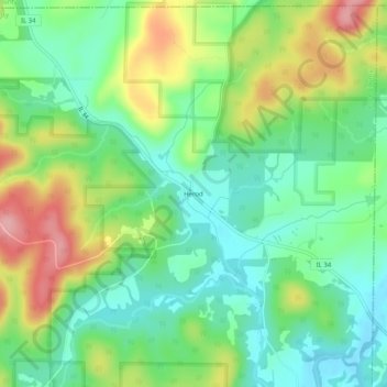
Name: Herod topographic map, elevation, terrain.
Location: Herod, Pope County, Illinois, 62947, United States (37.56033 -88.45615 37.60033 -88.41615)
Average elevation: 168 m
Minimum elevation: 117 m
Maximum elevation: 258 m
Thank you for supporting this site ❤️
Make a donation
Make a donation