
Thank you for supporting this site ❤️
Make a donation
Make a donation
Crooked Island topographic map
Click on the map to display elevation.
Thank you for supporting this site ❤️
Make a donation
Make a donation
About this map
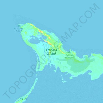
Name: Crooked Island topographic map, elevation, terrain.
Location: Crooked Island, Bahamas (22.65988 -74.34976 22.83752 -74.00377)
Average elevation: 1 m
Minimum elevation: -5 m
Maximum elevation: 33 m
Thank you for supporting this site ❤️
Make a donation
Make a donation
Other topographic maps
Click on a map to view its topography, its elevation and its terrain.