
Thank you for supporting this site ❤️
Make a donation
Make a donation
Horntown topographic map
Click on the map to display elevation.
Thank you for supporting this site ❤️
Make a donation
Make a donation
About this map
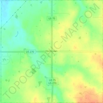
Name: Horntown topographic map, elevation, terrain.
Location: Horntown, Hughes County, Oklahoma, United States (35.07233 -96.26535 35.10148 -96.22995)
Average elevation: 255 m
Minimum elevation: 235 m
Maximum elevation: 274 m
Thank you for supporting this site ❤️
Make a donation
Make a donation